No edit summary Tags: Visual edit U36 R4.3 |
No edit summary Tags: Visual edit U36 R4.4 |
||
| Line 12: | Line 12: | ||
|sub = See page. |
|sub = See page. |
||
|added in = {{Update|15}}<br>(several updates since then)}} |
|added in = {{Update|15}}<br>(several updates since then)}} |
||
| − | {{Quote| |
+ | {{Quote|"And further still there are more lands, they say, but the Yellow Face is very hot there, and there are seldom any clouds, and the men are fierce and have dark faces."|Gollum, ''The Two Towers''|The Black Gate is Closed}} |
'''Near Harad''' is the vast, arid region located south of most of the Westlands of Middle-earth. The entire region is inhabited by peoples of the {{Faction|Near Harad|Haradrim}}. |
'''Near Harad''' is the vast, arid region located south of most of the Westlands of Middle-earth. The entire region is inhabited by peoples of the {{Faction|Near Harad|Haradrim}}. |
||
Revision as of 05:27, 27 August 2021
| “ | "And further still there are more lands, they say, but the Yellow Face is very hot there, and there are seldom any clouds, and the men are fierce and have dark faces." | ” |
–Gollum, The Two Towers, The Black Gate is Closed | ||
Near Harad is the vast, arid region located south of most of the Westlands of Middle-earth. The entire region is inhabited by peoples of the Haradrim.
The region stretches across the entire continent from west to east. It is bordered to the north by the river Harnen, the Ephel Dúath and the Khandwater river. To the south, the region borders the Harad Mountains and the vast grasslands of Far Harad, where the Morwaith dwell. At its core lies the Great Desert of Harad, and that central desert is surrounded by a number of more fertile regions.
The Haradrim of Near Harad are divided into five distinct peoples. The most well known are the Coast Southrons of the highly populated Southron Coasts in the west. They are close relatives of the Umbarians, a fertile and wealthy coastal region around the Havens of Umbar, and the peoples of the Harnedhrim of Harnennor in the north. In the southeast, there live the Gulfings of the Gulf of Harad. Between the Gulf and the Coastlands live the Nomads of the Great Desert. The ways of these peoples vary as much as the landscapes they depend on for a living. Yet they are bound by shared cultural values, descent, and history, and will therefore loyally support each other in case of need. Together they are referred to as the Southrons of Near Harad.
Main biomes of Near Harad
As the region is so vast, this page is meant to only provide an overview. More information on the main biomes, their sub-biomes and what can be encountered in them, is provided on each individual page for the biomes listed below.
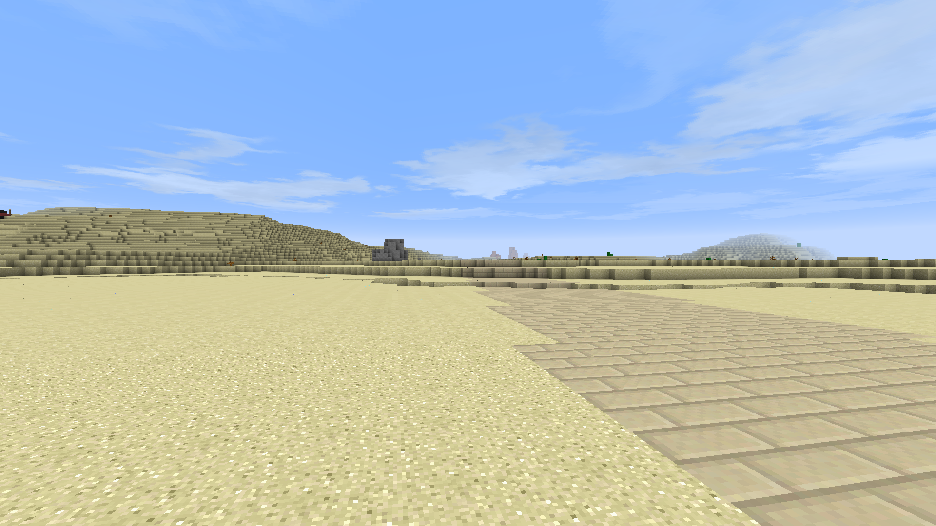
The Great Desert

The Great Desert lies at the heart of Near Harad. It is vast and barren, and its scorching sands hide many treasures. This sea of sand is perilous due to its high temperatures, but some brave souls venture into it anyway, seeking ancient ruins. This vast desert, including the half-desert lands bordering it, are inhabited by the Harad Nomads of Near Harad, wandering traders with a long history.
Harnennor

A semidesert land just south of Harondor, home to the Harnedhrim, a brutal subgroup of the Haradrim who seek vengeance for ancient wrongs committed by Gondor. Its people are fiercely independent, and seek to reclaim parts of their lands that the Men of Gondor stole from them millennia ago.
Lostladen

An uninhabited desert region that lies between Khand and Harnennor, made desolate by the power of Mordor. Standing beneath the shadow of the fences of Mordor, not even the Nomads dare to venture into this land.
Southron Coasts
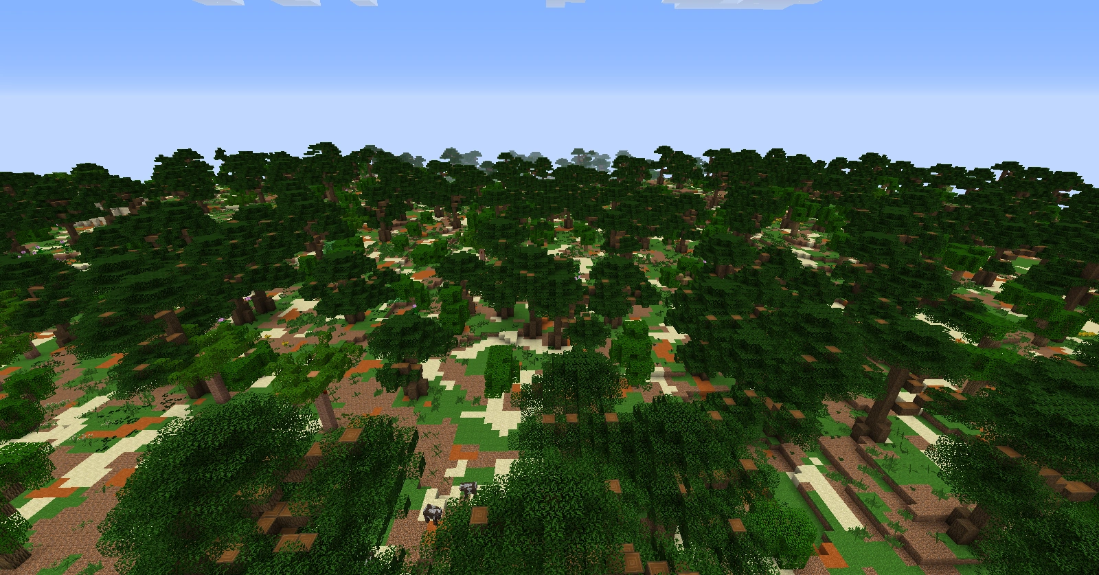
A great fertile land of many kingdoms on the western coast of Near Harad. The Southron Coasts are home to the Coast Southrons, the Men of the Great Serpent, some of the fiercest enemies of the West. This land is home to many towns and villages, as well as many riches.
Umbar

A fertile land home to the Corsairs of Umbar, the self-proclaimed lords of the Sea. Once the chief colony of ancient Númenor, Umbar is a rich land of hills, forests, and plains, ruled by the Umbarians. Home to the greatest city of the Haradwaith, it also serves as a shelter for Gondorian renegades.
Gulf of Harad

The fertile lands around a great gulf in southeastern Near Harad. The Gulfings that live here are a wayward people, devoted followers of the Lord of Darkness, to whom they will gladly sacrifice any gullible travelers. They Gulfings are also very wealthy, and their lands have long been a center of trade in the Sunlands. Merchants from across Near Harad and Far Harad alike come here to sell their wares.
Structures
The structures in Near Harad were almost all created by the Haradrim. All of these peoples have their specific needs for builds that suit their way of life. Thus, like the environments they live in, the architecture of the Southrons is very diverse. On the above mentioned biome pages, you can find overviews of the structures you can find in each of these regions.
Aside from the man-made structures, you can also find Mûmak Skeletons scattered throughout the region, except in Lostladen and Umbar.
Mobs
Next to the indigenous Southrons, only a few outsiders can be encountered in this land. Most of the trade within the region and in neighboring lands is covered by Nomad Merchants. The only travelers from the north that can come to these lands are Dorwinion Merchants. Morwaith mercenaries can be also found throughout the region, isolated in their own encampments.
The fauna of Near Harad is dominated by global and tropical common animals. In a few regions some of these species are more common than others because of the specific local geography and/or the climate. Noteworthy are the scorpions of the desert and the white oryx in the Gulf of Harad.
For more detailed information on mobs, see the pages for each of the above-mentioned biomes that can be found in each of them.
Mining
The underground world of Near Harad is home to all the standard ores, with the addition of Lapis Lazuli. Unlike in vanilla, lapis can only be found in Near Harad, albeit at the same rates and levels.
Vegetation
There is little vegetation in the desert of Near Harad. Here only dead trees grow, and very rarely at that. However, the fertile regions have grass, various colorful flowers, date palm trees, and stunted oaks. It is also one of the few places in the Mod were the player can find cacti, which can be used to make liqueur (based on real life tequila).
Trivia

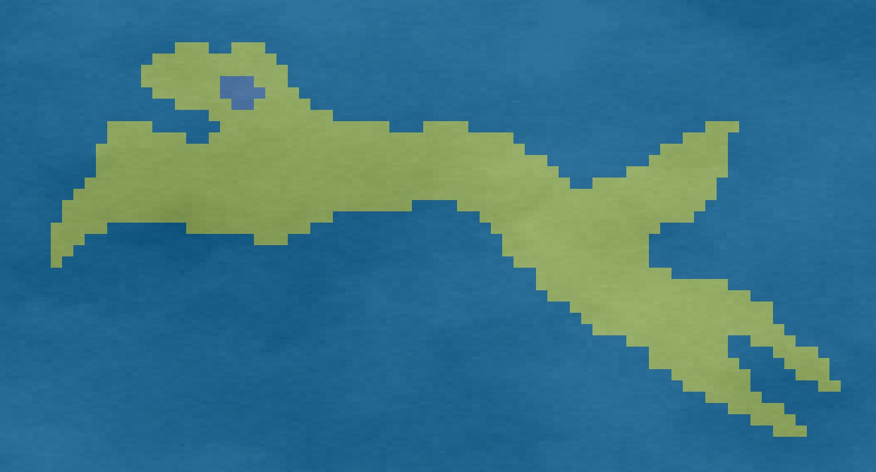
Dog-shaped island in the gulf of Harad
The map of Near Harad underwent a massive transformation with Update 34. Fans of doggos and in particularly the perceived "Haradoggo" in the map of Near Harad pre-Update-34, passionately lead by the inimitable Dragonovith,launched a massive promotional action to persuade the Mod Team to not let Haradoggo go with the introduction of Update 34. This resulted in the Haradoggo-shaped island in the northeast of the Gulf of Harad.
Gallery
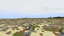
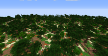
Near Harad Desert
")
")
")
")
")
")
")
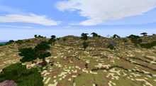
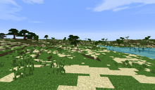
Near Harad Half-deserts
")
")
")
")
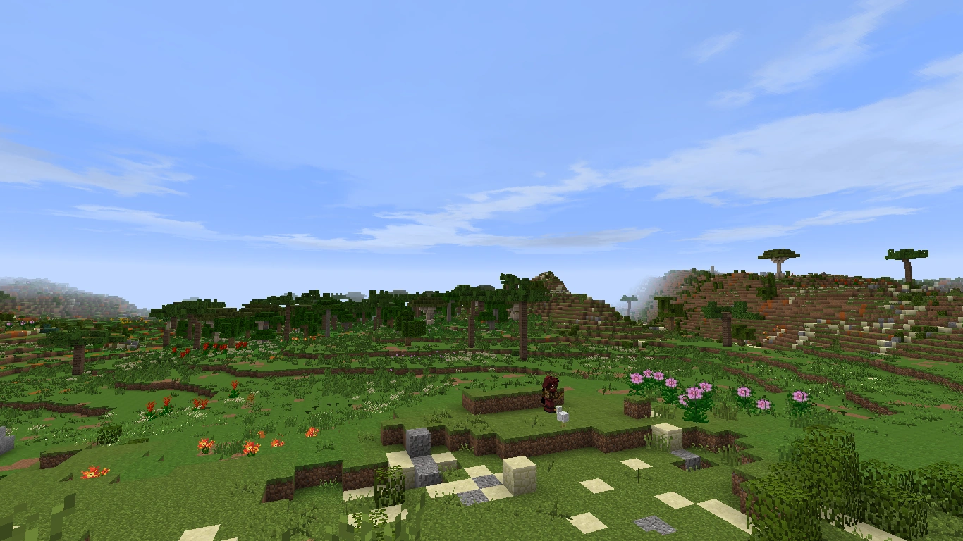
Southron Coasts
")
")
")
|
The Tolkien Gateway has an article on:
|
Near Harad
Coast •
Desert •
Gulf •
Harnennor •
Lostladen •
Umbar |